FLORIDA — Despite the social media noise and speculative forecasts, the 2025 Atlantic hurricane season is off to a calm and beneficial start. As of this week, no tropical depressions or storms are expected to develop in the Gulf of Mexico or the Caribbean for at least the next 7–10 days, according to official weather models and the National Weather Service.
Meteorologists say the slow beginning is not unusual — and, in fact, offers a much-needed reprieve for Florida, which is dealing with moderate to extreme drought across its southern half.
“On the fifth day of hurricane season, the typical gift is disorganized moisture from the south — and that’s just what we’re seeing,” one forecaster noted.
What’s Happening in the Tropics Right Now?
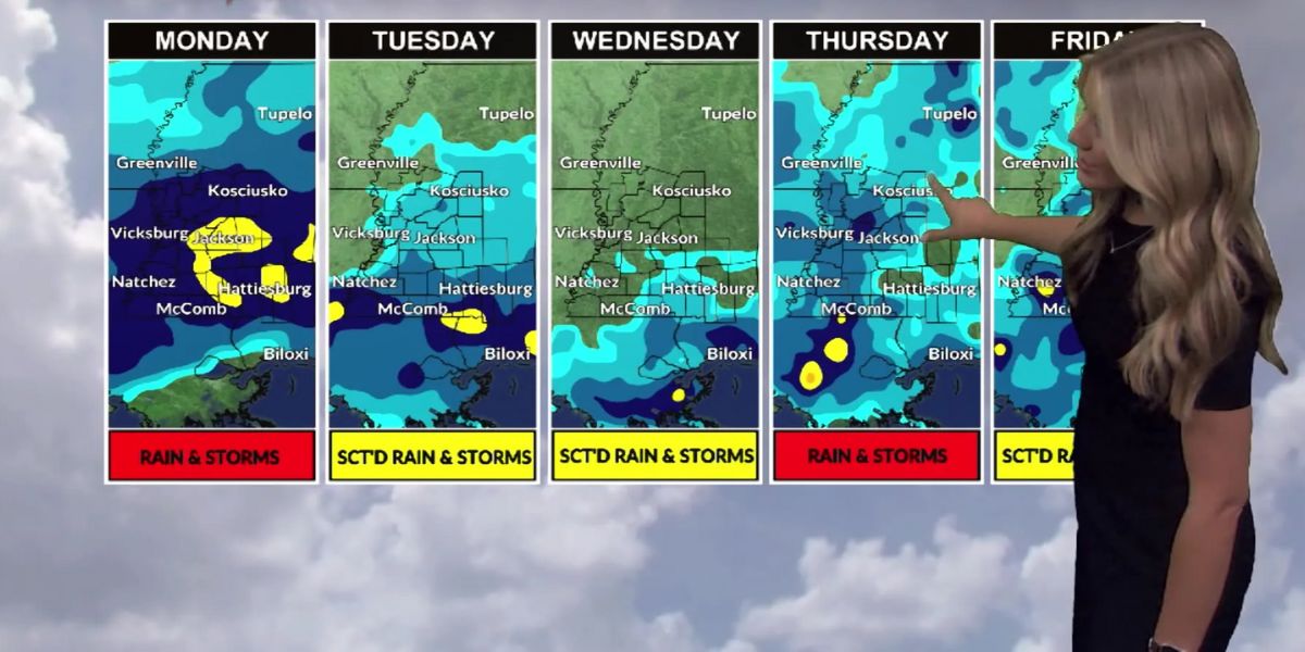
- A stalled frontal boundary and an upper-level low over the eastern Gulf have enhanced rainfall across the Florida peninsula.
- As of Wednesday afternoon, South Florida had seen 2–4 inches of rain, while Central Florida received 0.5 to 1 inch.
- The rainy pattern is expected to shift north over the next two days, with above-normal thunderstorm activity continuing through Thursday in the south and Friday in the north.
By the weekend, a weak low-pressure system could form over the Carolinas. However, since it’s developing mostly inland, tropical or subtropical development is unlikely.
The rest of the tropical Atlantic remains quiet, largely due to a thick layer of Saharan dust suppressing thunderstorm activity.
What Typically Happens in June?
Historical data shows that between June 1 and June 15, a tropical storm forms in the northwestern Caribbean or eastern Gulf once every three years. So far in 2025, upper-level wind conditions are more favorable for tropical development on the Pacific side of Central America, not the Atlantic — at least through mid-June.
What About That GFS Hurricane Forecast?
The GFS model (Global Forecast System), run by the U.S. government, has generated buzz online by repeatedly predicting a Caribbean hurricane forming 10 to 14 days from now. But meteorologists urge caution.
“The GFS has a known bias for forecasting phantom storms in early June,” experts warn. “Only three major hurricanes have ever occurred in June in the last 125 years.”
In short, long-range hurricane predictions beyond 7–10 days should be taken with skepticism, especially if they show intense systems forming out of nowhere. Most reputable forecasters agree: wait for confirmation across multiple models and timelines.
Stay Calm, Stay Ready
Despite the season’s quiet start, hurricane season is a marathon, not a sprint. It runs from June 1 to November 30, and even if the first few weeks are calm, dangerous systems can emerge at any point — often with little warning.
“Don’t let fantasy forecasts rattle you. Focus on being prepared, not scared,” one forecaster advised. “Trim your trees, check your emergency supplies, and sign up for trusted alert systems.”
Final Thought
There’s no need to panic-share every storm model you see online — and definitely no need to fear the Cyclone Imp (humorously invoked by some meteorologists to mock social media overreaction). The key is staying informed through official sources, not speculative clickbait.