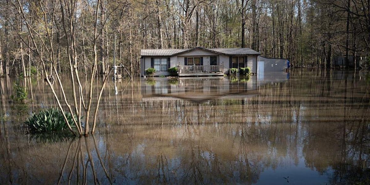

Two people have died and more than 86,000 residents remain without power after powerful storms ripped through parts of the southern United States over the weekend, bringing destructive winds, tornadoes, and torrential rain.
Falling Trees Claim Lives in Mississippi and Georgia
In Mississippi, Gov. Tate Reeves confirmed a fatality in Lafayette County, where a tree crashed onto a vehicle during the storms on Saturday. Multiple tornado warnings were issued across northern parts of the state.
In Georgia, a second person died under similar circumstances. According to Gov. Brian Kemp and the Georgia Emergency Management Agency, a tree fell on a car in Banks County Saturday night, killing one individual.
“Join us in praying for the loved ones of a Georgian tragically lost tonight due to the severe storms,” Kemp wrote on X (formerly Twitter).
Tornadoes and Severe Weather Stretch Across Multiple States
The National Weather Service (NWS) confirmed an EF-1 tornado touched down in Van Buren, Arkansas on Friday, damaging several homes and injuring one person.
By Sunday, the threat expanded to the Mid-Atlantic, with a tornado watch issued for parts of Washington D.C., Maryland, Virginia, and West Virginia.
The NWS warned Sunday night of continued danger:
“Severe thunderstorms with destructive winds, very large hail, a couple tornadoes, and excessive rainfall will move across southern Oklahoma and northern Texas overnight.”
Texas Hit Hard: Power Outages and Commute Disruptions
Texas was among the hardest-hit states, with over 86,000 outages reported Monday morning, according to poweroutage.us. Houston commuters were warned of significant disruptions during rush hour, with storms capable of producing wind gusts over 60 mph.
Two Storms Brewing Off the Mexican Coast
While the U.S. contends with inland weather chaos, two storms — Barbara and Cosme — are developing off the Pacific coast of Mexico.
- Storm Barbara is near hurricane strength with 70 mph winds and is currently located 185 miles southwest of Manzanillo, Mexico. The storm is forecast to dump 2–4 inches of rain on parts of Guerrero, Michoacán, Colima, and Jalisco, with the potential for localized flooding and mudslides. Dangerous surf and rip currents are expected to persist along the southwestern Mexican coastline.
- Storm Cosme, currently producing winds near 50 mph, is further south but expected to strengthen to hurricane intensity by Monday night. It is forecast to begin weakening late Tuesday into Wednesday.
Looking Ahead
Severe weather is expected to continue across parts of the Southeast and Upper Ohio Valley on Monday, with the NWS forecasting:
- Damaging winds
- Isolated tornadoes
- Large hail
- Risk of flash flooding, especially along the northern Gulf Coast and Northeast U.S.
Residents across the South and coastal Mexico are advised to remain alert, follow local emergency guidance, and monitor ongoing weather updates.