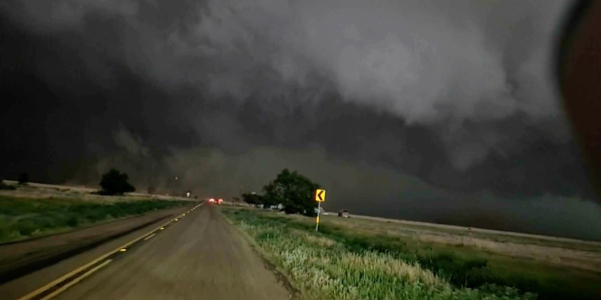
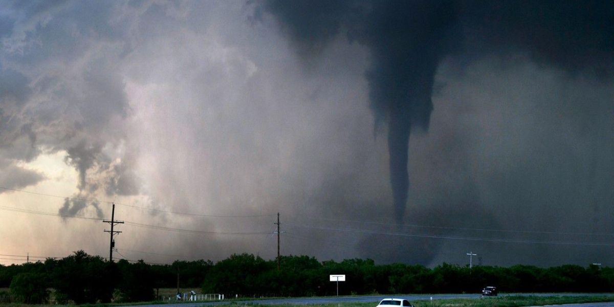
UNITED STATES — Tens of millions of Americans are under threat from a sprawling outbreak of severe weather this week, with violent thunderstorms, flooding rains, destructive winds, and the potential for tornadoes stretching from the Gulf Coast to the Great Lakes.
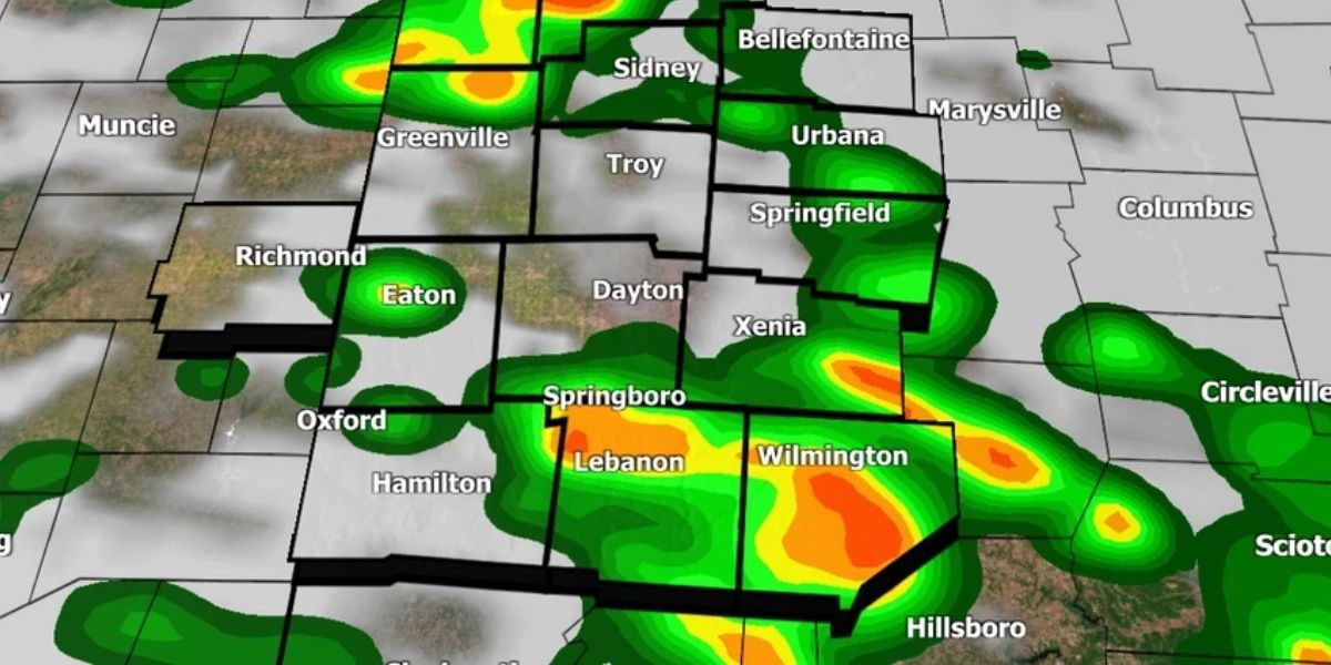
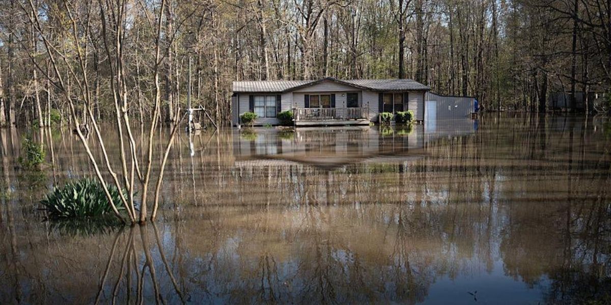
The National Weather Service (NWS) issued widespread severe thunderstorm watches and flood warnings Monday, citing the risk of 1 to 3 inches of rainfall, damaging gusts, large hail, and flash flooding across major population centers — including Houston, New Orleans, and regions as far north as western New York.
Texas and Louisiana Bear the Brunt
In Texas, Governor Greg Abbott activated emergency resources over the weekend in anticipation of worsening conditions, especially in communities still reeling from last week’s deadly storms. As of Monday, over 86,000 homes and businesses were without power, according to PowerOutage.us.
The NWS placed 12 southeastern Texas counties and parts of western Louisiana under active thunderstorm watches as storms continued to hammer the region. Persistent rainfall raised flood risks along major river systems already swollen from previous downpours.
“Texas stands ready to deploy all necessary resources,” Gov. Abbott said Sunday. “This weather system has the potential to bring flash flooding and heavy rain across our state.”
In Houston, forecasters warned of 1.5 to 4 inches of rain through midweek. The heaviest downpours are expected between Tuesday and Wednesday, posing risks of urban flooding and power outages.
Expanding Danger Zone
The same system is tracking eastward and northward, threatening communities from northern Texas and Alabama to western New York and northern Pennsylvania.
On Monday morning, the NWS in Birmingham, Alabama, issued a severe thunderstorm warning for central Alabama, warning residents of 60 mph winds and penny-sized hail. Damage to roofs, siding, and trees was likely.
“For your protection move to an interior room on the lowest floor of a building,” the weather service advised.
Flood watches were also in effect across western New York and Pennsylvania, where saturated ground has left the region vulnerable to flash flooding.
What’s Ahead This Week?
While Tuesday is expected to bring slightly lower risks for severe weather, forecasters are cautioning residents in western Texas and New Mexico to stay alert for isolated tornadoes, hail, and damaging wind gusts.
By midweek, storms are forecast to expand into the Carolinas, Midwest, and the Great Lakes, prompting fresh alerts from AccuWeather and NWS meteorologists.
On Wednesday, a new wave of storm activity is expected to ignite across the Upper Midwest, affecting areas like South Dakota and Wisconsin. Forecasters warned of potential hail, flash flooding, and winds of 50–60 mph.
Stay Informed, Stay Safe
The NWS and state officials urge residents in at-risk areas to:
- Monitor local alerts via weather apps and radio
- Avoid flooded roadways
- Prepare for possible power outages
- Secure outdoor items ahead of wind gusts
With conditions evolving quickly and the storm front spanning thousands of miles, officials say preparedness will be key to minimizing damage and keeping residents safe.
Have you been impacted by the recent storms or flooding? Share your experience or tips for staying safe in the comments below.